


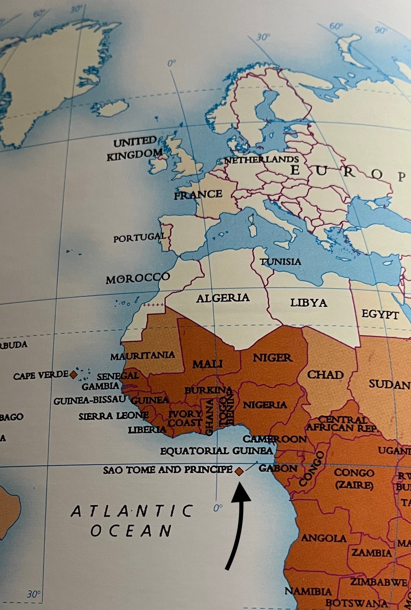
Where in the world is São Tomé?
On the Equator. But the Equator may not be quite where the Portuguese colonists thought it was.

In my last post I told how Franklin D Roosevelt ‘moved’ the Azores from Europe to the Americas. Now I’m going to go back to my first island journey, and how we found a little piece of misplaced geography. The Portuguese colonists got their geography wrong. It wasn’t deliberate: the poor things didn’t have iPhones.
I had spent the previous Christmas in hospital with my sick mother. This year my partner Donne and I wanted to go somewhere as unlike a Wiltshire hospital as possible. We started with a map, and somewhat randomly began in Algeria, moving down Africa through places like Burkina Faso and Mauretania. Intriguing, there must be much to find out, but travel advice was a little discouraging, as was the thought that I probably couldn’t get a beer on Christmas Day. So we slipped left a little and found the tiny country of São Tomé e Principe. It is a former Portuguese colony, which meant beer at least shouldn’t be a problem. It looked beautiful, and it is.
We knew little about Africa, and less about São Tomé e Principe. The first thing we discovered is that it is a ‘they’. São Tomé is one island, Principe another. Together they make up the second smallest country in Africa, with a touch over 200,000 people, and the 189th biggest in the world. They are pretty much on the Equator: 200 miles west of Gabon, 300 miles south of Nigeria. They are almost straight down the longitude line from Greenwich so are the closest bits of land to zero degrees both ways - the centre of the world, in a manner of speaking.
Here's a map that gives an idea
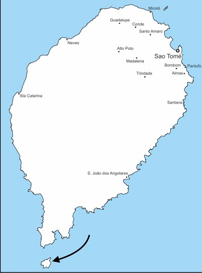
One of the first things we did – obviously – was to go and find the Equator. We knew roughly where it was: on Rolas Island, just south of São Tomé island:
We hired a car to get there. We should have taken more note when the man who delivered it was quite uninterested in the documents we had carefully printed out, but was keen to show us the spare tyre. We discovered why soon enough.
Not that we had a puncture, but that was more by the grace of God than anything else. The road from the airport to our hotel had been good, bar a few potholes, but when we headed south the tarmac started to disappear, and in many places the road was more hole than road.
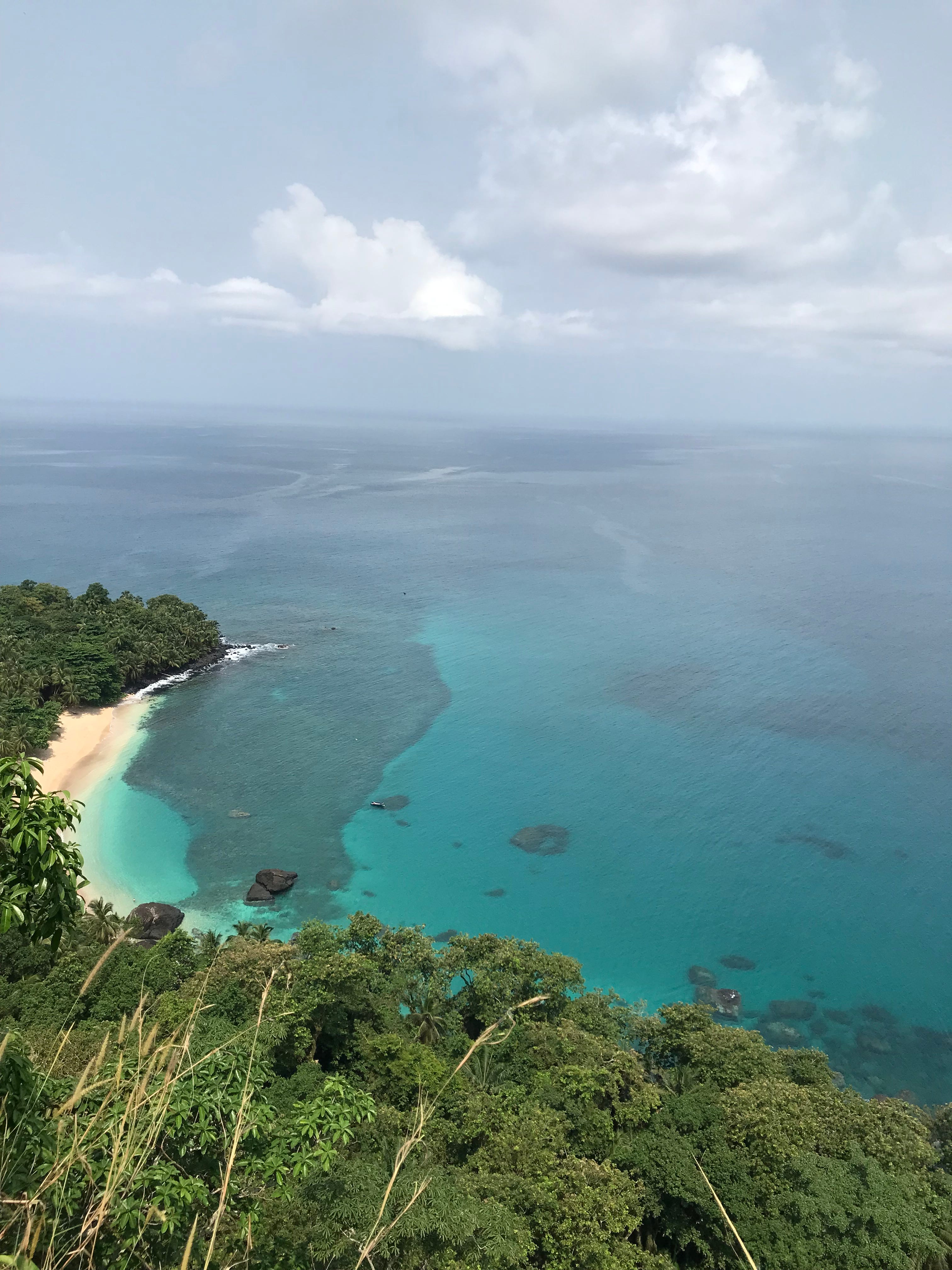
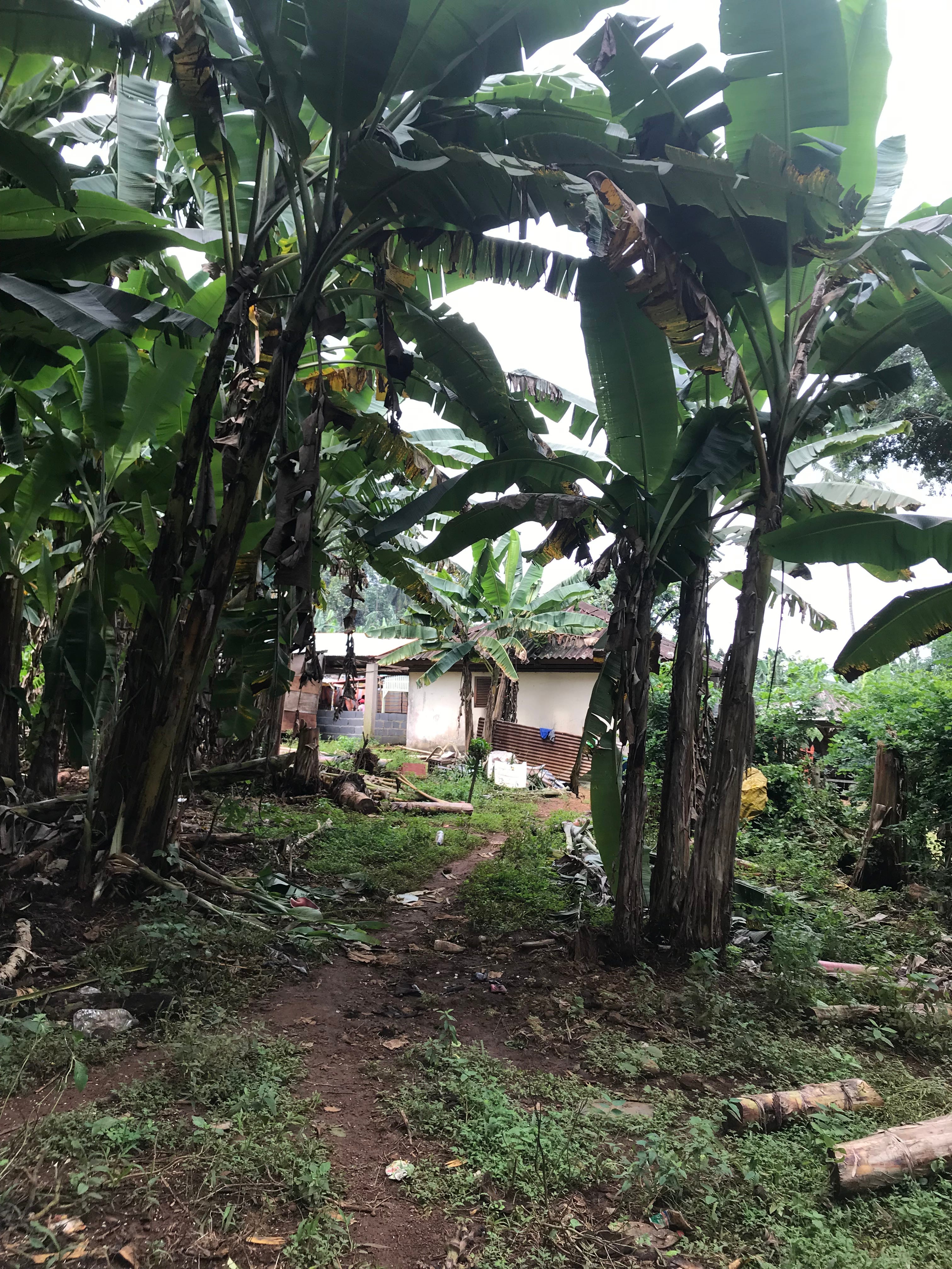
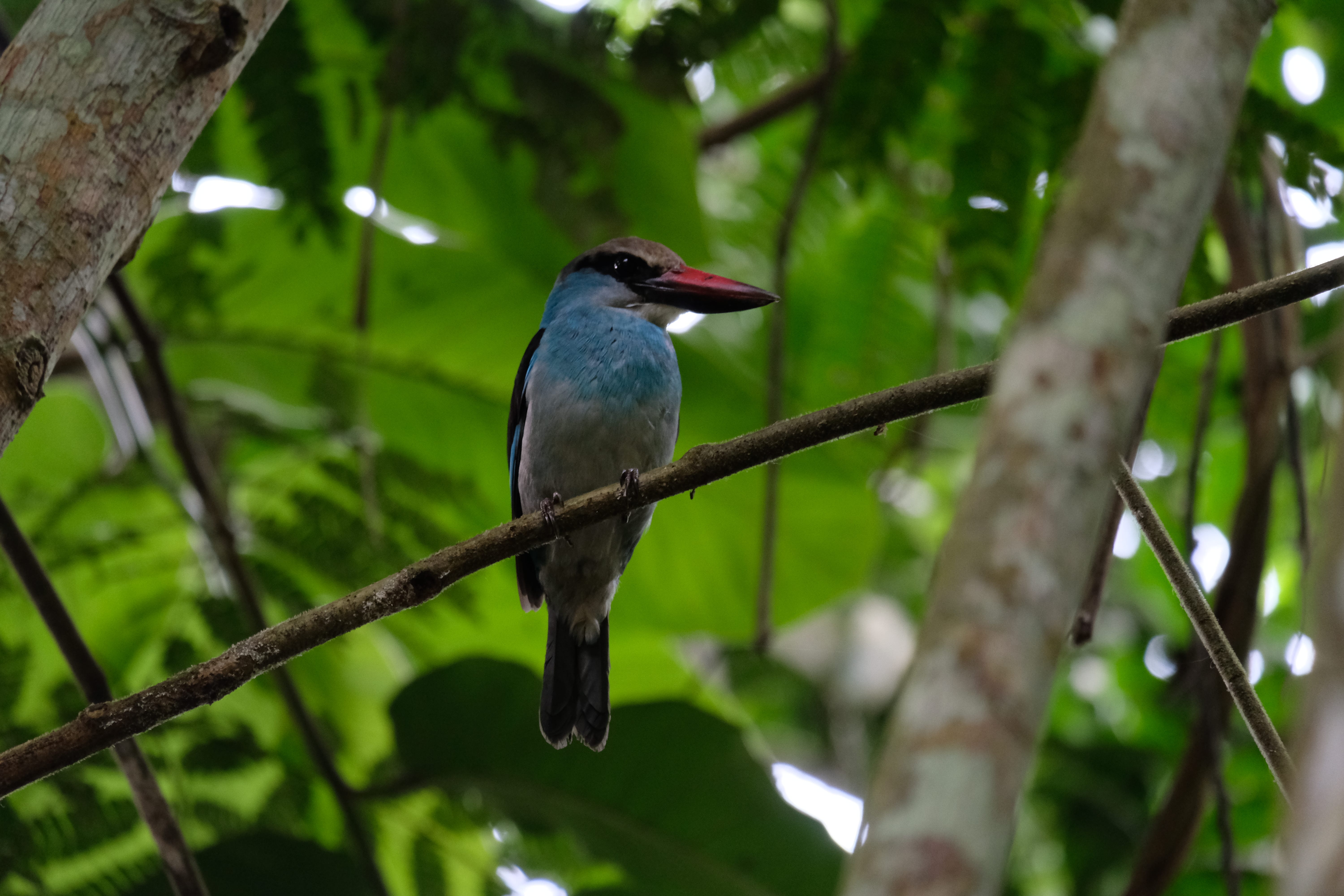
We got to the southern tip of São Tomé, just about, and were able to wonder at the wild beauty of the place on the way. The rain forest ruled, and was as unspoilt as you could imagine. We saw eagles swooping, the dramatically phallic Cão Grande – a volcano with only the lava plug left – and the odd sign of human habitation. Not mainly in the form of humans, but rather dogs wandering in the roads. In the few villages we passed through they were joined by goats, hens and particularly pigs – not great big fat ones, more on the scale of the dogs. Presumably they would eventually be turned into pork chops but for now they were snuffling around and having fun, much like the dogs.
A short boat ride and we came to Rolas Island. Most people come here to stay at the biggest hotel complex in the country, which is a bit depressing but must create jobs so that’s good. And we headed a little way south to find the Equator; or rather the monument the Portuguese had built to mark it.
As far as anyone knows, there were no humans on São Tomé until 1471, when João de Santarém and Pedro Escobar discovered it. It was December 21st – St Thomas’s Day, and still the national day – and that is where the island’s name came from. It remained a Portuguese colony until 1975. And at some point - I’d guess in the nineteenth century - the colonists decided they needed to mark the Equator, because that is what you do:
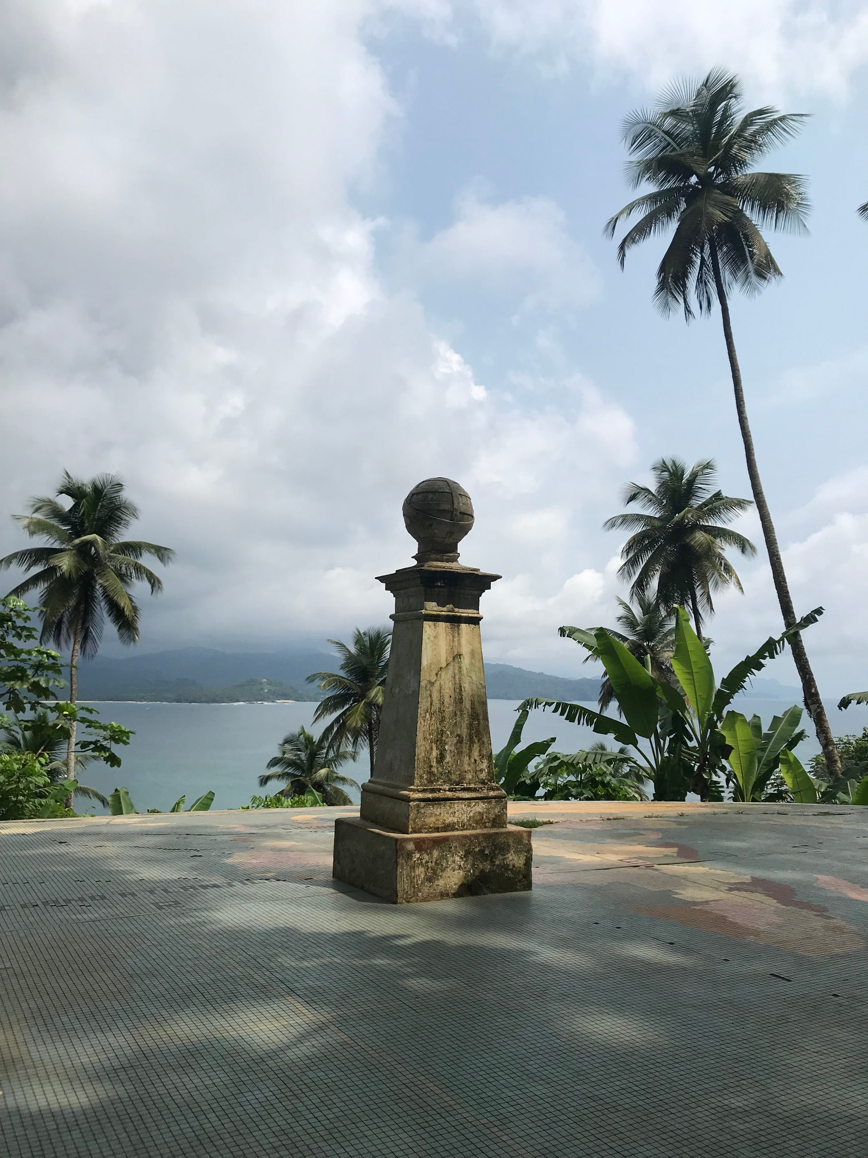
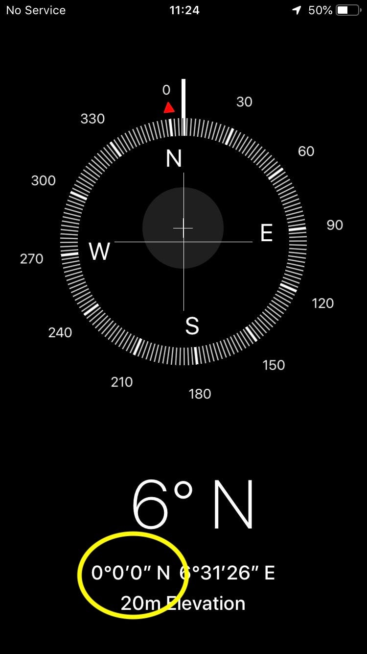
When you are looking for the Equator, you ideally need a sink with running water. Then you can see if the water twirls the other way as you go from one hemisphere to another. But we didn’t – so we had to make do with my iPhone, and that told us that the Gods of Apple disagreed with the Portuguese. We had to walk about 300 yards (or metres) north, and we found it, just here:
Here is Apple’s proof:
This is of course deeply unimportant. But it gave us our first taste of these islands. Their story is a devastating but fascinating mix of imperialism, chocolate and slavery, and I’ll get back to it. But the good news is that now – which is what counts – it is a peaceful country with lovely people, and amazing wildlife.
Very David. I enjoyed it because of, not despite, that. I liked the droplet of personal context, and the affection for the dogs and pigs. Very English too - modesty about the jeopardy of potholes, and irony about i-phones and it / they. I also learnt stuff! Tom