
Moving continents
Franklin D Roosevelt decided to move the Azores from Europe to America. It's strange the things that happen in wartime

This newsletter is about islands in the Atlantic and their histories. So I’m going to start right in the middle of the ocean - in the archipelago of the Azores. They are about 1,000 miles due west of Lisbon and 2,000 miles due east of New York. Iceland apart, they are the only land in the middle of the Atlantic.
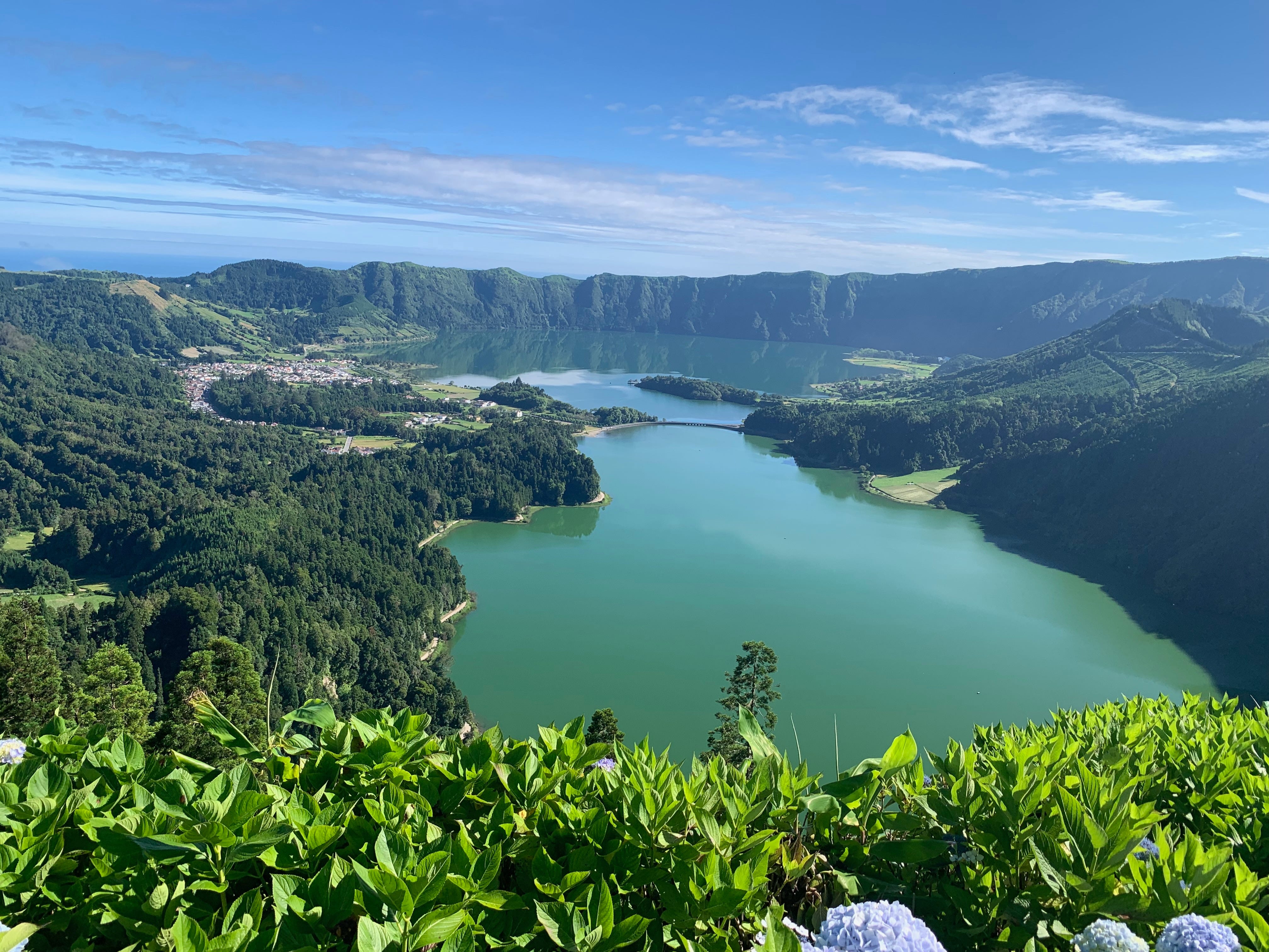
They’ve been Portuguese since they were discovered in the 15th century (as far as anyone knows there was no-one on them, so they really were discovered rather than appropriated). They are as remote (and beautiful) as you could want but in the Second World War their remoteness gave them a very special value. As merchant ships made their way from America to Britain, they went through the ‘Azores Gap’ - a vast area where German U-Boats could operate out of range of allied aircraft. A Milchkuhe (milk cow) submarine was stationed just off the island of Faial to keep them supplied. The Germans wanted the Azores as a base for their submarines. The British wanted them as a base for planes that could hunt submarines. The Portuguese, who owned them, wanted to keep them neutral.
But it was the Americans who made the boldest move. In April 1941 America was not yet in the War, but Franklin Roosevelt decided it was time to play around with geography - just in case he too needed to control the Azores.
In 1823 his predecessor James Monroe had said that if any European country tried to colonise any part of the Americas, the United States would treat that as a hostile act.
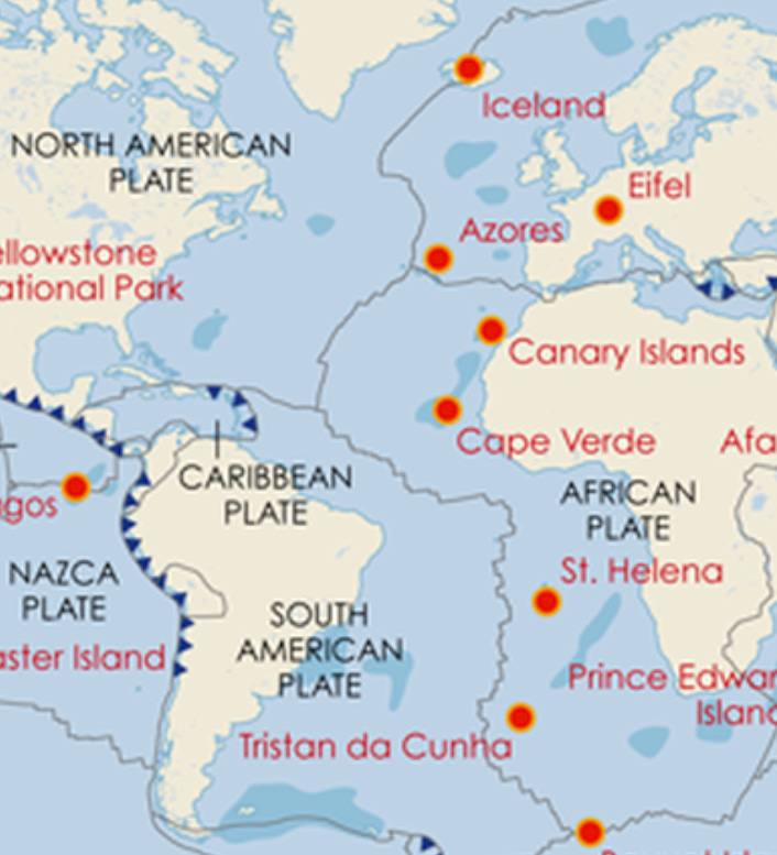
That was the Monroe Doctrine: it was designed to keep anyone else out of south America. If the Azores were in the Americas, they would be covered by the doctrine too. But Roosevelt had a problem: they weren’t. They were closer to Europe than to America, and they were certainly culturally European. Undeterred, he sent for his geographers. And they realised that if they thought geologically , they had a rather better case.
Here’s a map showing how the American, European and African plates come together - right at the Azores (no wonder there are so many volcanoes). Apologies if it’s a bit fuzzy, but I hope it gives the idea.
And here’s a more detailed one, showing where the nine islands of the archipelago sit.
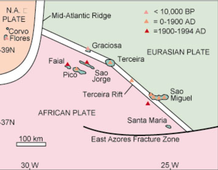
As you can see, it was not a very strong case. Only two of the nine islands - Flores and Corvo - are on the American plate. But two-ninths was good enough for for the president: he extended the Doctrine from by 15 degree of longitude - from 40 to 25 West. And that brought the Azores into the Americas. Magic.
It didn’t do the United States much good though. After an extraordinarily complicated negotiations it was the British who were allowed to build an airfield on the islands. Thanks to a treaty signed in 1372. That is a story I shall return to.
Bloody geologists!